Travel back in time using Google Maps
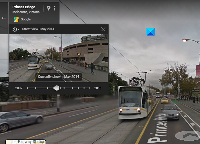
This feature is used by people to see how a place has evolved over the years. Google has gathered historic data, dating back to 2007, so you can see images as old as 15 years. Here is how you can use Google Maps and view images of various locations from the past: As you can see in the picture below, the timestamp is of May 2014. It really helps to observe the evolution if you drag the time slider all the way through. If you want to get back to the image at present, drag the slider to its right corner. An important thing to note here is that this function doesn’t exist in every single location, and there may be several landmark locations for which there is no historical data. This is how the street view corner looks if there is no data of the place of your choice. It has been found that the amount of data at your disposal is a function of where you live. Google’s Street View has a huge database that is ever-expanding, but if you can’t see the option to time travel, it means Street View passed your location only that one time.
Another important thing to note here is that this function is not present on your smartphones.
Why can’t I get Street View on Google Maps?
If you are not able to use the Street View feature on Google Maps, there are several solutions in place:
Check if Street View is available in your areaUse the Points of Interest (On your location, click on Nearby, and several points of interest, like Restaurants and Pubs, will show up)Use Google Search instead of Google Maps
Hope this helps!